Student study guide - 4th grade - Month-long unit (4 weeks)
Washington's story: land, people, and change.
Hi, historians! This is your month-long study guide. We will travel from ancient lava and
Ice Age floods to the rivers and sagebrush you can still see near Richland. Then we learn about Plateau peoples
since time immemorial, exploration and trade, settlement and treaties, statehood in 1889, dams and farms,
a careful Richland story, and Washington today. Read carefully, think kindly, and use evidence.
1889, railroads, irrigation, dams, careful Richland story, modern WA.
Week 1
Land shapes people
Basalt floods, Missoula floods, and reading Eastern Washington landscapes today.
Millions of years ago
1. Columbia River Basalt Group lava floods
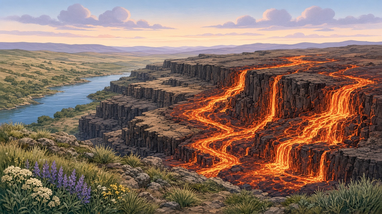
Long before people wrote books about this place, giant lava floods poured across the inland Northwest.
Scientists call this enormous set of eruptions the Columbia River Basalt Group. These were not small
cone-shaped volcano scenes from a cartoon. They were wide sheets of molten rock that spread for many miles.
When lava cools, it hardens into rock. The dark rock from these floods is called basalt.
Flood after flood stacked new layers on top of older layers, like a giant rocky layer cake. Over a stretch of time
so long it is hard to imagine -- millions of years -- those layers helped build the wide
Columbia Plateau.
Think about time this way: one school year feels long when you are waiting for summer. One human life is longer still.
Millions of years is far longer than that. The basalt story is a deep-time story. The rock under Eastern Washington
remembers events from a past too old for diaries, but not too old for science and careful looking.
Why do many basalt cliffs look like stair steps? Because each cooled flood can leave a shelf or layer.
Later, rivers and floods cut through the stack. When you look at the cliff face, you can see the layers as steps
or benches. Geologists read those steps as evidence. Fourth-grade historians can read them too: stacked rock means
repeated lava floods, not one single splash.
Word power
Basalt
Dark volcanic rock from cooled lava.
Columbia Plateau
A broad highland shaped in part by basalt layers.
Lava flood
A huge outpouring of lava that can cover wide areas.
Columbia River Basalt Group
The name for the ancient lava floods that stacked much of our plateau rock.
Stop and think: If lava floods stacked rock layers again and again, what might cliffs look like today? Why would a stair-step shape be a clue?
Stop and think: How is "millions of years" different from "a long time ago in my grandma's childhood"?
Layers of basalt remind us of ancient lava floods on the Columbia Plateau.
Ice Age
2. Missoula floods and channeled scablands
Much later -- still long before written U.S. history, but younger than the oldest basalt floods -- Earth was in an
Ice Age. In the northern Rocky Mountain country, glacial ice could form a giant
ice dam. Behind that dam, water piled up into an enormous lake scientists call
Glacial Lake Missoula.
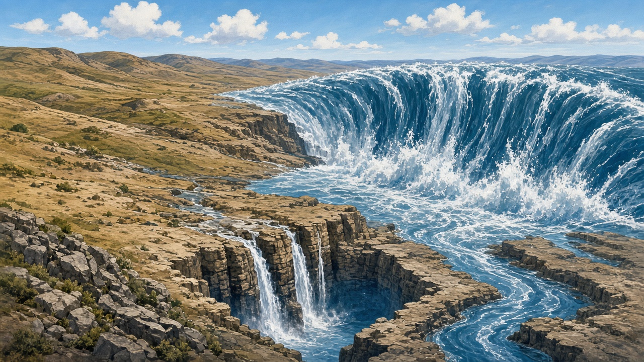
When the ice dam failed, the lake did not drain politely. It burst. Rushing water -- the
Missoula floods -- raced across the land with amazing power and speed. The floods were so strong
they could move huge rocks, cut new channels, and reshape whole landscapes. Then, in many cases, ice could rebuild
a dam, the lake could fill again, and another flood could happen. This was a story of repeated floods,
not only one.
Those floodwaters helped carve coulees (steep-sided dry canyons or channels), wide rocky channels,
and the rugged channeled scablands. A famous landform connected to this story is
Dry Falls -- a giant cliff and amphitheater where floodwater once poured. Today the falls are dry,
but the shape still shows how powerful the water was.
Kids near Richland and the Tri-Cities can look for connections: basalt walls along the river, open channel-like lands,
dramatic cliffs, and wide sagebrush country sitting on older rock stories. You do not need to visit every coulee to
understand the idea. The point is that the land around you is not random. It holds flood evidence you can learn to notice.
Imagine standing on a basalt overlook above the Columbia. Far below, the river bends like a silver road. Across the water,
cliffs show dark bands. Behind you, sagebrush whispers in the wind. A geologist might say: lava first, then Ice Age water,
then wind and weather finishing the sculpture. A 4th-grade historian can say almost the same thing in simpler words:
the land is a timeline you can see.
Coulees can look empty at first glance -- dry, rocky, quiet. But emptiness is a trick of the eye. Those channels once held
roaring floodwater. Dry Falls once was not dry. When we learn the Missoula story, quiet places become loud with history.
That is one of the joys of this unit: the playground of Eastern Washington turns into an outdoor museum.
Word power
Missoula floods
Giant Ice Age flood bursts that carved much of the scabland landscape.
Glacial Lake Missoula
The huge Ice Age lake held back by an ice dam.
Coulee
A steep-sided dry canyon or flood channel.
Channeled scablands
A landscape of channels, cliffs, and coulees shaped by giant floods.
Dry Falls
A dry cliff where Ice Age floodwaters once crashed down.
Stop and think: How is a flood that carves rock different from a regular rainy-day puddle?
Stop and think: Why does it matter that the Missoula floods happened more than once?
Ice Age floodwaters helped cut channels, coulees, and scablands.
Land today
3. Reading the land today
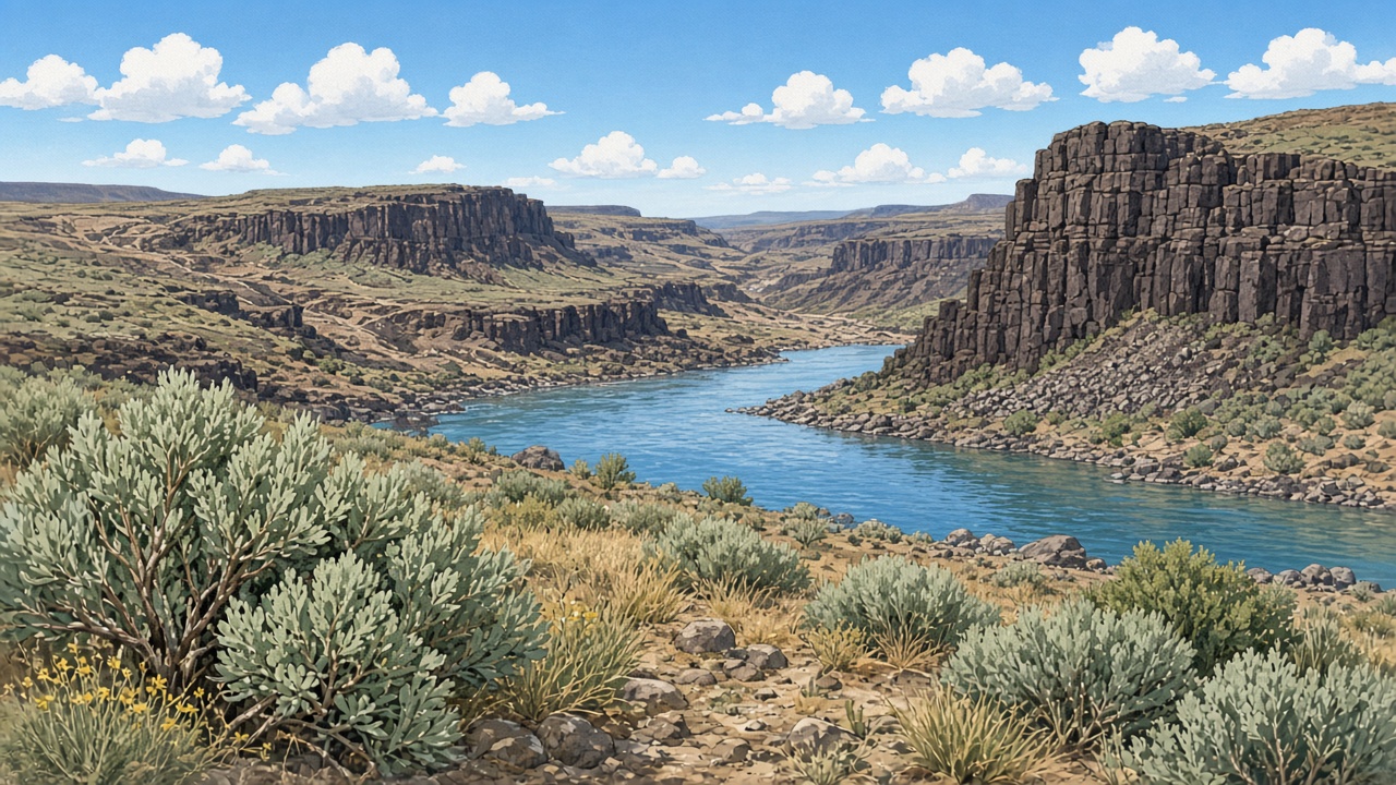
Today in Eastern Washington you can still see the Columbia River, basalt cliffs, open sky, and
sagebrush country. The land under our feet holds clues from lava and Ice Age floods.
A historian of place asks: What am I looking at? What older story might explain it?
The river is not just a pretty view. It is a travel corridor, a water source, a home for fish, and a shaper of towns.
The cliffs are not just "big rocks." They can be stacked basalt evidence. The open dry look of much of Eastern Washington
helps explain why irrigation later mattered so much for farms. When we learn people history next, we remember:
people made homes, traveled, fished, farmed, and built communities on this same landscape.
Good observers use careful words. We say "this cliff looks layered, which fits the basalt flood story," not
"I invent any story I want." Evidence first. Curiosity second. Respect always -- because the next chapters are about
real nations and real families.
Stop and think: Name one land feature near home that might connect to this deep-time story. What evidence makes you think so?
Stop and think: If you were giving a museum tour of Eastern Washington, which three outdoor "exhibits" would you point to first?
River, rock, and sagebrush: the land we share today.
Local lens: When you ride along the Columbia or see dark cliff bands near the Tri-Cities, practice saying:
"That rock may connect to basalt floods and later river cutting." You are reading place like a historian.
Week 1 review box
What rock formed when ancient lava floods cooled?
What held back Glacial Lake Missoula before floods burst out?
Name two landforms connected to the Missoula floods.
Write one sentence connecting Richland-area landscapes to this week's learning.
Week 2
Since time immemorial
Plateau peoples, rivers and salmon, trade, coastal contrast, and respectful learning.
Since time immemorial
4. Plateau peoples of the inland Northwest
Indigenous peoples of the Columbia Plateau have lived in the inland Northwest
since time immemorial -- longer than written records can hold.
That phrase matters. It tells us Washington's people story does not begin with explorers, wagons, or statehood.
It begins with Native nations whose families, languages, and teachings are rooted in these lands and waters.
Plateau life followed the seasons. Many communities moved through the year to fish, gather plant foods, hunt,
and gather in villages at important times. Rivers were highways and homelands. The Columbia and its tributaries
connected people to food, travel, and neighbors. Salmon were especially important for many
Plateau peoples -- as food, as a center of seasonal work, and as part of a larger relationship with the river.
Trade linked communities across long distances. Goods, ideas, and relationships moved along river corridors and trails.
People were not isolated dots on a blank map. They were part of living networks.
The inland Northwest includes many distinct nations and bands. When we name them, we try to be careful and accurate.
Among Plateau peoples connected to this broader region are nations and communities such as the
Yakama, Nez Perce (Nimiipuu), Umatilla, Cayuse,
Walla Walla, Wanapum, Palouse, Spokane,
and peoples of the Confederated Tribes of the Colville Reservation, along with other neighboring nations.
Each has its own history. We do not squash them into one invented story.
Classroom rule: we speak respectfully about tribal nations and their homelands. We do not invent sacred stories,
ceremonies, or sacred symbols. Teachers use OSPI Since Time Immemorial lessons for deeper, careful learning.
And we remember: these are living cultures today, with citizens, governments, families, and futures --
not only people "from long ago."
Foodways connected people to seasons. Fishing sites along the Columbia and its tributaries were busy workplaces and gathering places.
Root foods, berries, and other plant foods mattered too. Families passed on knowledge about when and where to harvest.
Trade fairs and exchanges could bring people together from distant valleys. A shell ornament, a woven item, or a tool might travel
far from where it was made -- evidence that Plateau life was connected, skilled, and organized.
Oral history is one way knowledge travels across generations. Elders and families teach through spoken stories and careful listening.
In school we treat oral history as a real source, not as "less than" a printed book. Written explorer journals are sources too,
but they are only one kind of window. When windows disagree, historians ask better questions instead of erasing someone.
If your class pairs this reading with OSPI Since Time Immemorial lessons, you may go deeper into tribal homelands, salmon,
or other carefully designed topics. Those lessons are built with tribal consultation in mind. This study guide is your bridge:
it prepares your brain for respectful, accurate learning.
Classroom reminder: Tribal nations are sovereign nations. Listening with respect is part of good history.
Word power
Since time immemorial
Native peoples have lived here since time beyond remembered written records.
Plateau peoples
Indigenous nations of the Columbia Plateau / inland Northwest.
Homeland
The lands and waters a people belong to across generations.
Seasonal round
Living through the year with different places and tasks as seasons change.
Oral history
Knowledge of the past shared through spoken stories and teachings.
Stop and think: Why should historians start with Native peoples when they tell Washington's story?
Stop and think: What is one reason salmon and rivers mattered to many Plateau peoples?
Stop and think: Why is it better to name several nations carefully than to pretend there was only one culture?
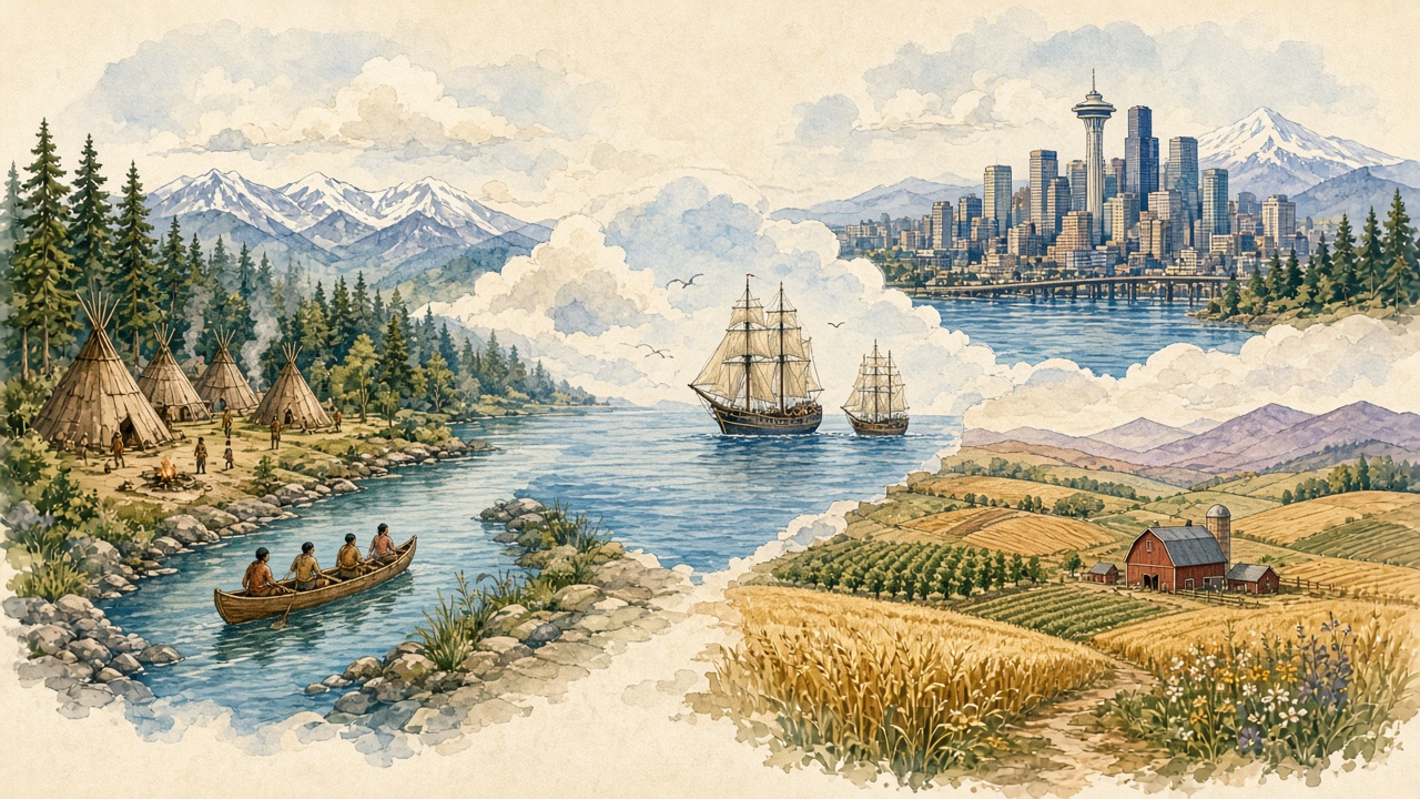
A bridge from land stories to people stories across time.Pacific Northwest contrast
5. Coastal contrast (brief)
West of the Cascades, many Indigenous peoples lived in different environments: wetter climates, dense forests,
and close ties to ocean and saltwater resources as well as rivers. Coast Salish peoples and other coastal nations
developed ways of life shaped by those places. Their houses, foods, and travel patterns could look different from
Plateau patterns because the land and water were different.
Even with those differences, we can notice shared Pacific Northwest themes: deep belonging to place, skilled use of
waterways, trade connections, family and community strength, and histories that begin since time immemorial.
Comparing environments helps us avoid one flat "all Native people were the same" mistake. Respect means noticing
both uniqueness and connection.
Stop and think: How can two regions in the same future state have different environments and still share important themes?
Week 2 review box
What does "since time immemorial" mean in your own words?
Name two Plateau nations or peoples from this reading.
Give one reason rivers mattered.
What is one respectful classroom rule for learning about tribal nations?
Week 3
Encounter to treaties
Exploration, fur trade, immigration, settlement, treaties, and multiple perspectives.
Late 1700s-1840s
6. Exploration and trade
In the late 1700s through about the 1840s, more maritime (by sea) and overland
travel brought new encounters across the Pacific Northwest. Ships arrived on the coast. Travelers moved inland along
rivers and trails. Traders and explorers met peoples who already knew these lands and waters well.
The Lewis and Clark era is one famous overland chapter from the early 1800s. Their Corps of Discovery
traveled to the Pacific and spent important time connected to the Columbia River system. At a 4th-grade level, we remember
a key truth: this was not empty land. Native nations already lived here. They traded, guided, warned, helped, and made
decisions of their own. Exploration was also encounter.
People exchanged goods, ideas, and information -- and they did not all experience those meetings the same way.
A newcomer might write about "discovery." A person whose family had lived on the river since time immemorial might
experience the same week as a complicated new pressure on homeland and trade. Good historians hold more than one perspective.
Maps from the exploration era can trick us. A line drawn by an expedition looks bold and new on paper. But the river under that line
already had names, crossings, fishing places, and memories. When Lewis and Clark traveled the Columbia country, they depended on
geography Native peoples already understood. Horses, canoes, food, and information did not appear from nowhere. Encounter means
relationship -- sometimes helpful, sometimes tense, always human.
Maritime explorers and traders on the coast met different nations and different resources than overland travelers inland.
Still, the shared pattern matters for Grade 4: the Pacific Northwest was full of people before U.S. state borders existed.
Washington history is older than Washington the state.
Stop and think: What is the difference between "discovering" a place and meeting people who already live there?
Quick claim practice: Finish this stem with evidence from the reading:
"Exploration changed the region because ______."
Fur trade era
7. Fur trade and early posts
The fur trade brought companies and traders who wanted beaver and other furs for distant markets. In the Pacific Northwest,
trading posts became meeting places. Native traders brought deep knowledge of land and animals. Newcomers brought goods from
far away. Exchange could create partnerships, rivalries, and big changes in daily life.
At a 4th-grade level, we do not need every company name memorized. We need the idea: posts were crossroads.
They linked Indigenous trade networks to global markets. They also brought new diseases, new pressures, and new contests
over power. The fur trade is one bridge between encounter and later settlement.
Diseases and new goods traveled together in this era. Populations and power could shift quickly. That is one reason later
settlement pressure hit communities that were already living through hard change. When Week 3 moves from trade posts to trails
and treaties, keep that bridge in mind.
Word power
Fur trade
Exchange of furs and goods that connected Native nations and newcomers.
Trading post
A place where people met to trade; often a hub of information and relationships.
Stop and think: Why might a trading post matter to both a Native trader and a newcomer trader -- maybe for different reasons?
1800s
8. Immigration and settlement
During the 1800s, more newcomers immigrated and settled. Some came for trade. Many came hoping for farmland and a new start.
Long overland journeys -- including the age-appropriate story of the Oregon Trail era -- meant months of hard travel.
Families faced weather, illness, rivers, and exhaustion. It was not a board game. It was a real migration that changed the map.
As farms, trails, towns, and new governments grew, pressure on Indigenous homelands grew too. Fences, cattle, plowed fields,
and new laws could block older travel routes and food places. Conflict over land was not a small side note. It is a central
part of Washington history. We study it with calm honesty.
When we say "settlement," we should hear two truths at once: newcomers were building lives they hoped would be better,
and tribal nations were defending homelands they already belonged to. Multiple perspectives keep both truths visible.
Some newcomers came in family groups. Some came alone first and sent for relatives later. Missionaries, farmers, merchants,
and laborers all appear in the broader story. Not every newcomer had the same power or the same dreams. Not every tribal nation
faced pressure in exactly the same way. History is detailed. Our job in 4th grade is to learn the big pattern without erasing
the people inside it.
The Oregon Trail era, told carefully, helps us imagine distance. Walking or riding for months is not the same as a weekend car trip
to Seattle. Supplies ran low. Weather turned dangerous. Yet thousands came. Their arrival changed who owned fences, who controlled
courts, and whose children filled new schoolhouses. Those changes are why Week 3 must include treaties in the next section.
Stop and think: Why can immigration stories and homeland stories both be true in the same decade?
Stop and think: If you could ask one respectful question of a settler child and one of a Plateau child in the 1850s, what would you ask?
Treaties and territory
9. Treaties and territory
A treaty is a formal agreement between nations. In the 1800s, tribal nations and the U.S. government made
treaties about land, rights, and relationships. Treaties matter because they are not casual handshakes. They are nation-to-nation
promises with lasting legal and moral weight.
Washington was a territory before it became a state. Territory status meant U.S. government control was growing,
but full statehood had not yet arrived. During territorial times, treaty-making and land pressure intensified.
Fourth graders also learn a hard fact framed carefully: many promises were broken. Lands reserved or rights protected in treaties
were often ignored or taken away later. That history still shapes trust, law, and civic conversations today. We do not need scary
detail to understand the main idea: agreements were made, and too often they were not honored.
Think of a classroom promise chart. If the class agrees to fair rules and then ignores them, trust breaks. Treaties are far more serious
than a classroom chart, but the feeling of a broken promise is something kids can understand. Adults in government made agreements with
tribal nations. Keeping those agreements is part of justice. Studying treaties is not about making 4th graders feel guilty for being alive.
It is about learning to be accurate, fair citizens.
Sovereignty means a nation's right to govern itself. Tribal nations are sovereign nations.
That idea helps explain why treaties were made between governments -- and why tribal governments still matter in Washington today.
Word power
Treaty
A formal agreement between nations.
Sovereignty
A nation's right to govern itself.
Territory
Land under a government's control before full statehood.
Stop and think: Why is "multiple perspectives" an important tool when we study settlement and treaties?
Stop and think: What does sovereignty mean, and why does it belong in a 4th-grade Washington unit?
Calm stem for big feelings: "One fact I know is ______. One question I still have is ______."
Week 3 review box
Why is "encounter" a better word than "empty-land discovery"?
What was one job of a fur trade post?
Define treaty in one kid sentence.
What does sovereignty mean?
Week 4
Statehood to today
1889, railroads and farms, dams, careful Hanford/Richland, and modern Washington.
1889
10. Path to statehood (1889)
In 1889, Washington became a U.S. state. That year is a memory hook for every classmate.
Statehood meant Washington joined the United States with a state constitution and state government, after years as a territory.
Communities grew. Railroads, towns, farms, and businesses expanded. Newspapers, schools, and local governments multiplied.
Statehood did not erase earlier stories. It added a new chapter on top of deep Native history and earlier territorial change.
When we celebrate 1889, we also keep Weeks 1-3 on the timeline.
State government meant new offices, laws, and symbols. Counties and towns continued to grow. Schools expanded as more families arrived.
Eastern and western Washington sometimes wanted different things because their climates and economies differed -- a geography lesson hiding
inside a civics lesson. Your unit keeps asking the same smart question: How does place shape people, and how do people reshape place?
Memory hook: 1889 -- Washington joins as a state. Timeline checkpoint!
Stop and think: What year should you lock into memory for Washington statehood? Why does statehood not erase Native history?
Late 1800s - early 1900s
11. Railroads, towns, farming, and irrigation in Eastern WA
Railroads changed speed. Goods that once moved slowly by wagon or river could travel farther and faster by train.
Towns grew near rail lines. Farmers could send crops to distant markets. People could move more easily between places.
The railroad map helped shape which communities boomed.
Eastern Washington has a drier climate than the rainy west side. Wide farms needed water. Irrigation systems --
canals, ditches, and planned water delivery -- brought river water to dry farmland so crops could grow. Irrigation turned
parts of the Columbia Plateau into rich agricultural country. Apples, wheat, potatoes, hops, and many other crops became
part of the region's story.
Towns and farms depended on each other. Stores needed customers. Farmers needed tools, markets, and transportation.
The growth was exciting for many newcomers. It also continued to reshape land use on Indigenous homelands.
Both ideas can sit on the same page of your notebook.
Word power
Railroad
Train lines that moved people and goods and helped towns grow.
Irrigation
Moving water to farmland so crops can grow in dry places.
Stop and think: Why would irrigation matter more in Eastern Washington than in a rainy coastal forest?
1900s river change
12. Dams and rivers
In the twentieth century, large dams rose on the Columbia and other rivers. Dams can make electricity,
store water, help irrigation, and change flood patterns. For many communities, dams meant power for homes and industry
and more reliable water for farms.
Dams also changed life for fish. Salmon need pathways between ocean and spawning streams. When rivers are blocked or altered,
fish runs can shrink or need special help such as fish ladders and careful management. Remember Week 2: salmon mattered deeply
to Plateau peoples. Dam building is one reason river history and tribal treaty fishing rights still appear in modern news and civics.
Historians do not have to pick a cartoon "dams good" or "dams bad" slogan. They can say: dams brought benefits for people
and costs for fish and older river patterns. Washingtonians still work on that balance today.
Stop and think: Name one way dams helped people and one way dams changed fish or rivers.
World War II era
13. WWII and Hanford / Richland (careful, age-appropriate)
During World War II, the United States built a huge science and engineering project at Hanford, near the
Tri-Cities. Workers and families arrived quickly. A community that had been much smaller grew into a busy wartime place.
Housing, schools, and jobs expanded. People sometimes call this kind of rapid planned growth a "secret city" story because
much of the work was kept quiet for security reasons.
In 4th grade we keep this description careful. Hanford was major government science and engineering work during wartime,
and it changed local growth. We focus on place and people changes -- how Richland grew, how workers came, how community
identity formed -- not on graphic weapon detail. Curiosity about community is welcome. Fear and sensational talk are not the goal.
After the war, science, engineering, and related work continued to shape the Tri-Cities. Families still live with that history
as part of local identity. If your family has stories, they are part of the living record. In class we share carefully and factually.
Richland's wartime growth shows how national events can transform a local place almost overnight. Schools filled. Neighborhoods spread.
Jobs drew people from many states. The Columbia River setting mattered for the project and for daily life. When we say "Richland story,"
we mean real families who cooked dinner, walked to school, and built community while history moved quickly around them.
Later decades added new chapters: cleanup and environmental work, science research, agriculture nearby, sports, arts, and the everyday
life you know. The point for historians is continuity. The 1940s matter because they changed the path under today's feet.
Stop and think: What is one careful, factual sentence you can write about why Richland grew in the 1940s?
Modern Washington
14. Modern Washington -- how the past shapes the present
Washington today has busy Pacific coast cities and wide inland farm country. Industries include technology, aerospace,
shipping, agriculture, tourism, government, and science. Eastern Washington still depends on rivers, irrigation, and transportation.
The Cascades still divide climates. The Columbia still ties places together.
Tribal nations are part of modern civic life. They govern, educate, do business, protect resources, and uphold treaty rights.
Learning Weeks 2 and 3 helps you understand headlines and community decisions in Weeks "right now."
Environment and economy often meet in the same conversation: salmon and dams, farms and water, cities and growth, wildfire and forests,
rivers and recreation. When you hear those debates, you can bring timeline knowledge. You can ask: What older stories help explain
this choice? Whose perspectives should be included?
You are not just memorizing dates. You are practicing citizenship. Washington's past -- geology, Indigenous nations, encounter,
treaties, statehood, and local growth -- still shapes the present you live in near Orchard Elementary and beyond.
Look at a modern Washington map with new eyes. Interstates follow older travel needs. Farms still drink from engineered water systems.
Cities glow with electricity from a river network that includes dams. Tribal flags and governments remind us that sovereignty did not
end in a museum case. Your study guide timeline is not only "old stuff." It is a key ring for unlocking today's Washington.
As you finish the month, practice the historian habits you earned: put events in order, define words precisely, use multiple perspectives,
and support claims with evidence. Those habits will help in every subject -- and in life outside school.
Stop and think: Name one way rivers still shape life in Eastern Washington.
Stop and think: Write a claim stem: "My claim about Washington history is ______ because ______."
Week 4 review box
What year did Washington become a state?
How did irrigation help Eastern Washington farms?
Give one benefit and one cost connected to dams.
Write one careful sentence about Hanford/Richland growth.
How does tribal sovereignty still matter in modern Washington?
Historian skills to practice all month
These habits make your reading stronger in every week.
Use evidence
Point to a sentence, a map detail, or a land clue. Say, "I know this because ______."
Keep time in order
Basalt before Missoula. Peoples before explorers. Territory before 1889. Practice aloud with a partner.
Hold perspectives
Ask how the same event might look different to different groups. Use calm, fair words.
Choose respectful language
Say tribal nations, homelands, and sovereignty. Do not invent sacred stories. Remember living cultures today.
Partner challenge: Pick any week review box. Take turns answering while your partner checks the study guide for evidence.
Expanded visual timeline
Follow the picture, then read the checkpoints aloud with a partner. Add sticky notes for details you remember.
Millions of years agoColumbia River Basalt Group lava floods
Basalt layers stack into the Columbia Plateau; stair-step cliffs later reveal the layers.
Ice AgeGlacial Lake Missoula and Missoula floods
Ice dam failures send repeated floods; coulees, scablands, and Dry Falls take shape.
Land today cluesRiver, basalt, sagebrush country
Eastern Washington landscapes preserve evidence of deep-time stories.
Since time immemorialPlateau peoples (and coastal nations west of Cascades)
Homelands, salmon, seasonal living, trade networks, oral history, living cultures.
Late 1700s-early 1800sMaritime encounter and coastal trade expand
Ships and trade bring new meetings on the Pacific coast.
Early 1800sLewis and Clark era on the Columbia
Overland expedition travels through Native homelands; encounter, not empty land.
Fur trade decadesPosts and exchange networks
Trading hubs link Indigenous networks to wider markets.
Nation-to-nation agreements; many promises later broken.
1889Washington statehood
Territory becomes a state; older stories remain.
Late 1800s-1900sRailroads, towns, irrigation farming
Eastern WA agriculture expands with water systems and transport.
1900sMajor dams on the Columbia system
Power and irrigation grow; salmon and river life change.
1940sHanford wartime project and Richland growth
Science/engineering work reshapes the Tri-Cities community.
TodayModern Washington
Cities, farms, tribal nations, civic debates, environment, and local identity.
Check for understanding
Twenty-four or more questions in the bank -- each round shows eight. You get feedback right away.
Reset draws a fresh set. No grades stored -- just practice!
Loading question...
Printable study packet
Name:Date:
Mrs. Mandeville's 4th Grade Class -- Washington State History Month Unit
A. Fill in the blanks
Dark rock from cooled lava floods is called .
The scientific name for the ancient lava floods is the Columbia River Group.
Giant Ice Age flood bursts that carved coulees are the floods.
Glacial Lake Missoula was held back by an dam.
A steep-sided dry canyon or flood channel is a .
Native peoples have lived here since time .
A formal agreement between nations is a .
A nation's right to govern itself is called .
Washington became a state in the year .
Bringing water to dry farmland is called .
B. Matching
Write the letter of the best match on each line.
Columbia Plateau ______
Channeled scablands ______
Dry Falls ______
Lewis and Clark era ______
Sovereignty ______
Hanford / Richland ______
Oral history ______
Irrigation ______
A. A nation's right to govern itself
B. Landscape carved by giant floods
C. Highland built in part by basalt layers
D. Early 1800s exploration / encounter chapter
E. Wartime science project that shaped local growth
F. Knowledge shared through spoken teachings
G. Moving water to farmland
H. Giant dry cliff where Ice Age floodwaters once poured
C. Short answers
Why do basalt cliffs often look like stair steps?
Why do rivers and salmon matter in Plateau peoples' history?
What is the difference between discovering empty land and encountering people who already live there?
Give one reason treaties still matter when we make decisions today.
Name one benefit and one cost connected to dams on Washington rivers.
D. Timeline put-in-order
Number these 1-8 in the order they belong (1 = earliest).
Washington statehood (1889)
Missoula floods carve scablands
Plateau peoples since time immemorial
Columbia River Basalt Group lava floods
Hanford wartime project and Richland growth
Lewis and Clark era / exploration and encounter
Treaties, territory, and settlement pressure
Large dams and irrigation reshape rivers and farms
E. Claim + evidence paragraph
Write 4-6 sentences. Use this stem to start:
"My claim about Washington history is ______ because ______."
Include at least two pieces of evidence from the study guide. Use respectful language.
Mrs. Mandeville's 4th Grade Class - Orchard Elementary - Washington State History