Classroom planning - Month-long Washington State History unit
Teacher Aide for a full 4-week, evidence-rich Washington unit.
Use this page to plan about 20 school days (4 weeks). Students work in the Student Study Guide (long-form story, timeline, printable packet, quiz). Geology is a local place prologue; history eras follow OSPI Grade 4 Washington State History, including tribal history. Pair every people week with OSPI Since Time Immemorial (STI) companion lessons.
Unit overview
Big idea, essential questions, enduring understandings, standards, and materials.
Big idea
The land of Eastern Washington was shaped over deep time by lava floods and Ice Age waters. People have lived with this land since time immemorial. Later eras of exploration, settlement, treaties, statehood, and modern growth layered new stories on top of older ones. Fourth graders can connect geology, Indigenous history, and civic life using evidence and respectful language.
Essential questions
- How do basalt layers and Ice Age floods help explain the land we see near Richland today?
- What does it mean that Plateau peoples have lived here since time immemorial?
- How did exploration, immigration, and treaties change life for different groups?
- How did Washington become a state, and how did farms, railroads, dams, and wartime work reshape communities?
- How does the past still inform choices about land, water, respect, and citizenship today?
Enduring understandings
- Landforms are evidence of past processes we can read like clues.
- Indigenous nations are living sovereign nations with deep ties to place.
- Historical events look different from different perspectives.
- Treaties are nation-to-nation agreements with lasting importance.
- Strong historians use timelines, vocabulary, and claim-with-evidence thinking.
OSPI Grade 4 alignment
Focus: Washington State History including local tribal history. Geology is an added place-based prologue with geography connections.
H1.4.1- Create and use timelines / understand eras (expanded site timeline + weekly ordering practice).H1.4.2- Eras: tribes since time immemorial; exploration/trade; immigration/settlement; territory/treaty-making to 1889 -- plus geologic prologue (basalt + Missoula) for Eastern WA place.H1.4.3- Tribal growth/history prior to 1889 (respectful multi-day overview; pair with STI).H4.4.1- Historical events informing current decisions (water, land, community growth, treaty respect, environment).H4.4.2- Evidence-based claims about Washington and tribal nations (weekly stems + final paragraph).
Geography connections: map the Columbia River, Columbia Plateau, Cascades vs. Eastern WA climate contrast, and how physical features influenced travel, trade, farming, and towns.
Materials list
Every week
- Devices or printed Study Guide sections
- Washington wall map / Columbia Plateau map
- Student notebooks or packet pages
- Exit ticket slips or sticky notes
- Sentence stem posters (claim / evidence / perspective)
Nice to have
- Basalt sample or labeled photo set
- Dry Falls / coulee image cards
- STI printed lesson pages
- Simple timeline clothesline across the room
- Local guest / virtual tribal education resources (as approved)
Week 1 objectives
- Describe lava floods of the Columbia River Basalt Group in kid-friendly deep-time language.
- Explain how stacked basalt layers create stair-step cliffs.
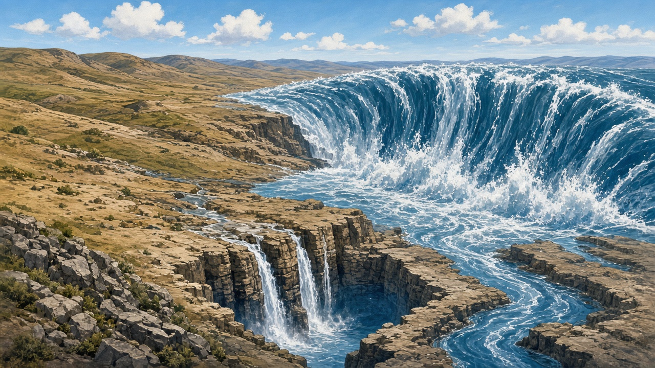
- Retell the Missoula floods story: ice dam, Glacial Lake Missoula, repeated floods, coulees, Dry Falls, scablands.
- Connect local Richland / Tri-Cities landscape clues to the geologic story.
- Use a simple map key for river, plateau, and major landforms.
Key vocabulary
- basalt, lava flood, Columbia Plateau, layer / strata
- Ice Age, ice dam, Glacial Lake Missoula, Missoula floods
- coulee, channeled scablands, Dry Falls
- sagebrush country, evidence, landform
Assign Study Guide: Basalt floods; Missoula floods; Reading the land today; Week 1 review box.
Day-by-day suggested flow
Day 1 -- Hook the land under our feet
Flow: Look out the window or at land-today image. Ask: What clues do rock and river give us? Introduce deep time with a simple analogy (school year vs. millions of years). Read Study Guide basalt opening paragraphs together.
Activity: Layer-cake demo (paper strips or stacked books labeled as lava floods). Students sketch a stair-step cliff and label "older layer" / "newer layer."
Formative: Exit ticket -- "Basalt is ______ because ______."
Differentiation: Provide labeled diagram; partners for sketch; oral dictation option.
Day 2 -- Columbia River Basalt Group
Flow: Reread basalt section. Discuss why cliffs look stair-stepped. Vocabulary card sort: basalt / plateau / lava flood / layer.
Activity: Map work -- shade approximate Columbia Plateau on a WA outline; mark Columbia River.
Discussion: "If lava floods happened again and again, what evidence should still be visible?"
Formative: Two-sentence summary on sticky note.
Day 3 -- Missoula floods story
Flow: Tell ice-dam story with gestures (lake grows, dam fails, water races). Read Missoula study section. Emphasize repeated floods, not one single event.
Activity: Sequence cards: ice dam forms / lake fills / dam fails / flood carves land / dam rebuilds.
Discussion: "How is a Missoula flood different from a rainy-day puddle?"
Formative: Order the five cards correctly in notebook.
Day 4 -- Coulees, Dry Falls, scablands, Tri-Cities connection
Flow: Image walk: coulee, scablands, Dry Falls, local basalt walls. Connect to places students may know (river cliffs, open channels, sagebrush hills).
Activity: "Evidence detective" chart: Feature / What it suggests / How I know.
Formative: One row of the chart completed accurately.
Differentiation: Pre-filled first row; word bank on board.
Day 5 -- Week 1 synthesis
Flow: Complete Week 1 review box in Study Guide. Partner teach: one student teaches basalt, one teaches Missoula.
Activity: Mini quiz oral whip-around or Study Guide matching practice from packet Section A (geology items).
Formative: Week 1 check -- 4 question quick quiz (paper or board).
Assign: Finish any unread Week 1 study pages; preview Week 2 opener.
Week 2 objectives
- Explain "since time immemorial" in student language.
- Describe seasonal living, villages/trade, and salmon importance for Plateau peoples.
- Name several Plateau nations carefully (Yakama, Nez Perce, Umatilla, Cayuse, Walla Walla, Wanapum, Spokane, Colville Confederated Tribes, and others as appropriate).
- Contrast coastal and Plateau environments at a high level without stereotypes.
- Treat oral history as a valid historical source; practice respectful classroom norms.
Key vocabulary
- since time immemorial, Indigenous, tribal nation, Plateau peoples
- homeland, salmon, seasonal round, trade network
- oral history, respect, sovereignty (intro)
- Coast Salish (brief contrast term)
Assign Study Guide: Plateau peoples; Coastal contrast; Week 2 review. Launch STI Tribal Homelands / Salmon lessons in parallel.
Day-by-day suggested flow
Day 1 -- Since time immemorial as the right starting point
Flow: Reset the timeline: geology first, then people long before written U.S. history. Teach the phrase since time immemorial. Read opening Plateau peoples paragraphs.
Activity: Norms chart: We use accurate names. We do not invent sacred stories. We listen for living cultures, not "only in the past."
Formative: Students restate one classroom norm in their own words.
Day 2 -- Rivers, salmon, seasons, trade
Flow: Deep read on seasonal living and salmon. Link to Columbia River on the map. Discuss trade as connection, not isolation.
Activity: Season wheel: spring / summer / fall / winter -- place sample activities from the reading (fishing, gathering, travel, village life) with teacher guidance. Avoid inventing ceremonial detail.
Discussion: "Why should historians start Washington's people story with Native nations?"
Formative: One evidence sentence: "Salmon mattered because ______."
Day 3 -- Nations of the Plateau (careful naming)
Flow: Introduce major Plateau peoples with map dots. Stress diversity: many nations and bands, not one single culture. Note living communities today.
Activity: Name-and-place matching with a simple map key (teacher-created cards).
Differentiation: Fewer cards for some students; challenge extension = add one respectful fact from STI materials.
Formative: Exit ticket naming two Plateau nations and one shared theme (river/salmon/trade).
Day 4 -- Brief coastal contrast + oral history
Flow: Compare environments: coastal rain forests and ocean resources vs. inland rivers and drier plateau. Shared PNW themes: family, water, trade, deep time on the land.
Activity: Venn diagram (Coastal / Both / Plateau). Mini lesson: oral history is a source historians take seriously.
Formative: Two items correctly placed in the Venn.
Day 5 -- STI companion day + Week 2 review
Flow: Teach or continue an OSPI STI elementary lesson (Tribal Homelands or Salmon). Complete Week 2 review box.
Activity: Respectful Q&A protocol: "One fact I know / One question I still have."
Formative: Week 2 check -- short answers on salmon + since time immemorial.
Week 3 objectives
- Describe maritime and overland exploration/trade in the late 1700s-1840s as encounter, not empty-land discovery.
- Summarize Lewis and Clark era travel on the Columbia with Native presence centered.
- Explain fur trade posts as meeting places that changed relationships.
- Describe why newcomers immigrated and how settlement created conflict over land.
- Define treaty, territory, and sovereignty; acknowledge broken promises as historical fact framed for 4th grade.
Key vocabulary
- exploration, encounter, maritime, overland
- fur trade, trading post, immigration, settlement
- Oregon Trail (age-appropriate), pioneer (use carefully)
- treaty, territory, sovereignty, perspective, promise
Assign Study Guide: Exploration and trade; Fur trade; Immigration and settlement; Treaties and territory; Week 3 review.
Day-by-day suggested flow
Day 1 -- Exploration as encounter
Flow: Teach the difference between "discovering empty land" and "meeting people who already live there." Read exploration section. Place late 1700s-1840s on the class timeline.
Activity: Claim stem: "Exploration changed the region because ______."
Formative: Students avoid empty-land language in their stem.
Day 2 -- Lewis and Clark era on the Columbia + fur trade
Flow: Map the Columbia route at a simple level. Emphasize Native knowledge, trade, and guiding. Read fur trade paragraphs: posts as exchange hubs.
Activity: Two-voice poem or dual journal: trader / Plateau community member (keep factual, not cartoonish).
Discussion: "How can two groups experience the same meeting differently?"
Formative: One accurate detail from each voice.
Day 3 -- Immigration, trails, and settlement pressure
Flow: Why people came (land, farms, new starts). Age-appropriate Oregon Trail: long hard journey, not a game. Farms and towns grow; pressure on Indigenous homelands increases.
Activity: Cause/effect chart: Newcomers arrive / Effects for settlers / Effects for tribal nations.
Differentiation: Sentence frames for each column; advanced students add a third effect.
Formative: Chart has at least one valid effect in each column.
Day 4 -- Treaties, territory, sovereignty
Flow: Define treaty as nation-to-nation agreement. Define territory (Washington Territory before 1889). Introduce sovereignty. State clearly that many promises were broken -- calm, factual, 4th-grade framing.
Activity: Vocabulary triangles: word / kid definition / why it matters.
Sensitive tip: Watch for overload; use "One fact / One question" protocol.
Formative: Correct kid definitions for treaty and sovereignty.
Day 5 -- Multiple perspectives + Week 3 review
Flow: Practice perspective stems. Complete Week 3 review. Optional STI Celilo Falls connection if timing allows.
Activity: Mini debate rules = respectful evidence only (no winners needed): "Why do treaties still matter?"
Formative: Week 3 check -- matching treaties/territory/sovereignty + one short answer.
Week 4 objectives
- Lock 1889 as Washington statehood and explain territory-to-state change.
- Describe railroads, towns, farming, and irrigation in Eastern WA.
- Explain dams as change for people and fish (tie to earlier salmon knowledge).
- Describe Hanford/Richland growth in age-appropriate wartime science/engineering terms.
- Connect past to present: industries, cities, agriculture, tribal nations today, civic life.
- Produce a final claim-with-evidence paragraph.
Key vocabulary
- statehood (1889), railroad, irrigation, dam
- Hanford, Richland, wartime project, secret city (careful)
- industry, agriculture, environment, civic life
- claim, evidence, lasting impact
Assign Study Guide: Path to statehood; Railroads/towns/farming; Dams and rivers; WWII Hanford/Richland; Modern Washington; Week 4 review; full packet; quiz rounds.
Day-by-day suggested flow
Day 1 -- 1889 statehood and growth
Flow: Memory hook: 1889. Read statehood section. Add to timeline. Discuss that statehood adds a chapter; it does not erase Native history.
Activity: Before/after statehood T-chart (government status / daily life examples from reading).
Formative: Students write 1889 correctly and one non-erasure sentence.
Day 2 -- Railroads, towns, farming, irrigation
Flow: How trains linked towns and markets. Eastern WA farming needed water: irrigation canals and systems. Connect to dry climate vs. river water.
Activity: Systems sketch: river -> canal -> farm -> town -> railroad.
Formative: Labeled sketch with at least four parts.
Day 3 -- Dams, rivers, salmon connection
Flow: Dams changed power, flooding patterns, irrigation, and fish passage. Revisit Week 2 salmon knowledge. Keep tone balanced: benefits and costs.
Activity: Two-column notes: Ways dams helped people / Ways dams changed fish and rivers.
Discussion: "How do rivers still shape life in Eastern Washington?"
Formative: One valid note in each column.
Day 4 -- Hanford / Richland carefully + modern Washington
Flow: Age-appropriate: huge WWII science/engineering project; secret-city growth; lasting community identity. No graphic weapon detail. Then modern WA: cities, farms, tribal nations today, civic life.
Activity: Local identity web: work / science / river / schools / family stories (invite careful sharing).
Sensitive tip: Families may have local ties; listen; keep factual.
Formative: One careful factual sentence about Richland growth + one modern connection.
Day 5 -- Cumulative assessment day
Flow: Complete remaining packet sections. Run quiz (8 of 24+). Write final claim-with-evidence paragraph. Celebrate timeline mastery.
Activity: Final paragraph using stem: "My claim about Washington history is ______ because ______." Optional share-aloud.
Summative pieces: Packet accuracy, quiz practice score (formative or light grade), paragraph rubric (claim clarity + evidence + respectful language).
Differentiation across the month
Built-in supports you can use any week without rewriting the unit.
Support
- Partner reading for long study sections
- Vocabulary cards with icons / sketches
- Sentence stems posted all month
- Pre-highlighted evidence sentences
- Oral responses in place of long writing when needed
Extension
- Extra timeline entries with student research cards
- Compare two landform photos with evidence captions
- STI extension tasks after Week 2 and Week 3
- Local photo scavenger hunt (ethical / safe)
- Claim paragraph with two pieces of cited evidence
Full unit vocabulary glossary
Kid-friendly definitions for the month. Revisit weekly.
- Basalt
- A dark volcanic rock. In our region, thick basalt layers came from giant lava floods long ago.
- Columbia Plateau
- A wide highland area in the inland Northwest built in part by those basalt layers.
- Columbia River Basalt Group
- The scientific name for the huge set of ancient lava floods that stacked basalt across the plateau.
- Lava flood
- A very large outpouring of lava that can cover wide areas before it cools into rock.
- Missoula floods
- Huge Ice Age flood bursts that raced across the land and helped carve dramatic valleys and coulees.
- Glacial Lake Missoula
- An enormous Ice Age lake held back by an ice dam; when the dam failed, floodwater escaped.
- Ice dam
- A blockage made of glacial ice that can hold back a lake until it breaks.
- Channeled scablands
- A torn-up looking landscape of channels, cliffs, and coulees shaped by those giant floods.
- Coulee
- A steep-sided dry canyon or channel -- a landform students may hear about in Eastern Washington.
- Dry Falls
- A giant dry cliff and amphitheater where Ice Age floodwaters once poured; dry today but still dramatic.
- Sagebrush country
- Open, drier landscape common in Eastern Washington where sagebrush and grasses are common.
- Landform
- A natural shape on Earth's surface, such as a cliff, coulee, plateau, or river valley.
- Evidence
- Clues or facts we use to support a claim about the past or the land.
- Since time immemorial
- A way to say Native peoples have lived here for so long that it reaches beyond written memory.
- Indigenous / Native
- Referring to the first peoples of a place and their descendants.
- Plateau peoples
- Indigenous nations of the Columbia Plateau / inland Northwest with deep ties to rivers and lands.
- Homeland
- The lands and waters a people belong to and have lived with across generations.
- Seasonal round
- Moving through the year with different places and tasks as seasons change (fishing, gathering, village life).
- Oral history
- Knowledge of the past shared through spoken stories and teachings; a real historical source.
- Trade network
- Connections that let people exchange goods and ideas across long distances.
- Exploration
- Traveling to learn about places; in this unit, also an encounter with peoples already living here.
- Encounter
- A meeting between peoples; not the same as finding empty land.
- Maritime
- Related to the sea; maritime travel means coming by ocean.
- Overland
- Travel across land, such as long trails and river corridors.
- Fur trade
- Exchange of furs and other goods that brought traders and Native nations into close contact.
- Immigration
- Moving into a region to live; many newcomers arrived in the 1800s seeking land and opportunity.
- Settlement
- Building farms, towns, and new governments on the land -- which also created conflict over homelands.
- Treaty
- A formal agreement between nations. Treaties between tribal nations and the U.S. government shaped rights and land.
- Sovereignty
- A nation's right to govern itself. Tribal nations are sovereign nations.
- Territory
- Land under a government's control before full statehood (Washington Territory came before 1889).
- Statehood
- When a place becomes an official U.S. state. Washington's statehood year is 1889.
- Irrigation
- Bringing water to dry farmland through canals and systems so crops can grow.
- Dam
- A barrier on a river that changes water flow for power, storage, or farming -- and also affects fish.
- Railroad
- Train lines that moved people and goods and helped towns grow.
- Hanford
- A large World War II-era science and engineering project near the Tri-Cities that shaped local growth.
- Claim
- A clear statement you can support with evidence.
- Perspective
- A point of view; different groups can experience the same time differently.
Assessment plan
Mix of quick checks, study packet, quiz practice, and a final writing piece.
Formative (ongoing)
- Daily exit tickets (1-2 sentences)
- Week review boxes in the Study Guide
- Map and vocabulary checks
- Discussion stems with evidence
- Online quiz rounds for practice (8 questions drawn from 24+; immediate feedback; reset anytime)
Summative (end of unit)
- Printable study packet (fill-in, matching, short answer, timeline order, claim+evidence)
- Final claim-with-evidence paragraph (rubric: clear claim, specific evidence, respectful accurate language, on-topic)
- Optional: oral share of one timeline era + why it matters today
Suggested paragraph rubric (simple)
- Claim is clear and about Washington land or history.
- Evidence comes from the study guide or class learning (not only opinion).
- Language is respectful and accurate (especially about tribal nations and Hanford).
- Mechanics are readable for Grade 4.
Sensitive-topic guidance
Tribal sovereignty and treaties
- Use accurate, respectful language: tribal nations, homelands, sovereignty.
- Do not invent sacred stories, ceremonies, or sacred symbols.
- Center that treaties are nation-to-nation agreements with lasting importance.
- Name broken promises as historical fact without graphic violence detail.
- Lean on OSPI STI and local tribal education resources when going deeper.
- Emphasize living cultures today -- not only "long ago."
Hanford / Richland
- Keep it age-appropriate: a large wartime science and engineering project that shaped Richland's growth.
- Avoid graphic, scary, or sensational weapon detail.
- Invite curiosity about community change, work, and place -- not fear.
- Families with local ties may share memories; listen with care and keep classroom talk factual.
- If hard questions arise, park them for teacher follow-up rather than speculation.
How to use the Student Study Guide and quiz
- Assign study sections by week to match this pacing guide.
- Pause for Stop and think boxes; use them as turn-and-talk prompts.
- Use the visual timeline image plus the expanded text timeline for H1.4.1 practice.
- Print the multi-section study packet for centers, homework, or Friday checks (Name line + class footer appear in print).
- Quiz: 24+ questions in the bank; each load shows 8 at random with immediate feedback. Use "New set of 8" for reteaching -- nothing is stored or graded on a server.
- End of unit: claim-with-evidence paragraph using stems from Weeks 1-4.
Print this Teacher Aide (or the outline section below) for a compact unit plan. Chrome and nav hide in print view.
Printable unit outline
Compact overview for your plan book or a substitute folder.
Washington State History -- 4-week unit (Grade 4)
Big idea: Land shaped by deep-time geology; people since time immemorial; exploration, treaties, statehood, and modern Washington -- connected with evidence.
- Week 1 -- Land shapes people: Basalt floods; Missoula floods/scablands; reading Eastern WA today; maps; geology vocab. Study: sections 1-3.
- Week 2 -- Since time immemorial: Plateau peoples; salmon/rivers/trade; coastal contrast; oral history; STI companion. Study: sections 4-5.
- Week 3 -- Encounter to treaties: Exploration/trade; fur trade; immigration/settlement; treaties/territory/sovereignty. Study: sections 6-9.
- Week 4 -- Statehood to today: 1889; railroads/irrigation; dams; careful Hanford/Richland; modern WA; cumulative assessment. Study: sections 10-14 + packet + quiz.
Standards: H1.4.1, H1.4.2, H1.4.3, H4.4.1, H4.4.2 + geography connections + STI.
Assess: Exit tickets; week reviews; study packet; quiz practice (8 of 24+); final claim-with-evidence paragraph.
Links: Hub ../ -- Study Guide ../study/ -- Class home https://mrs-mandeville.com/